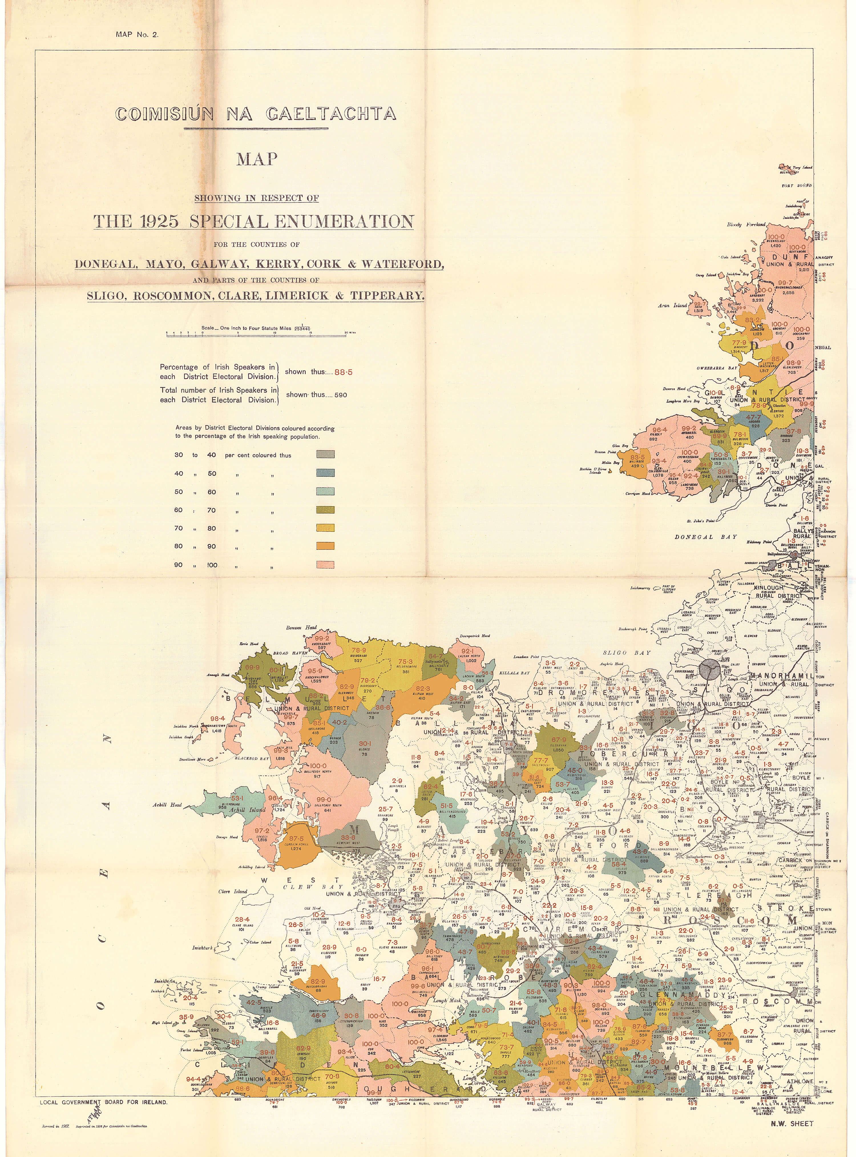
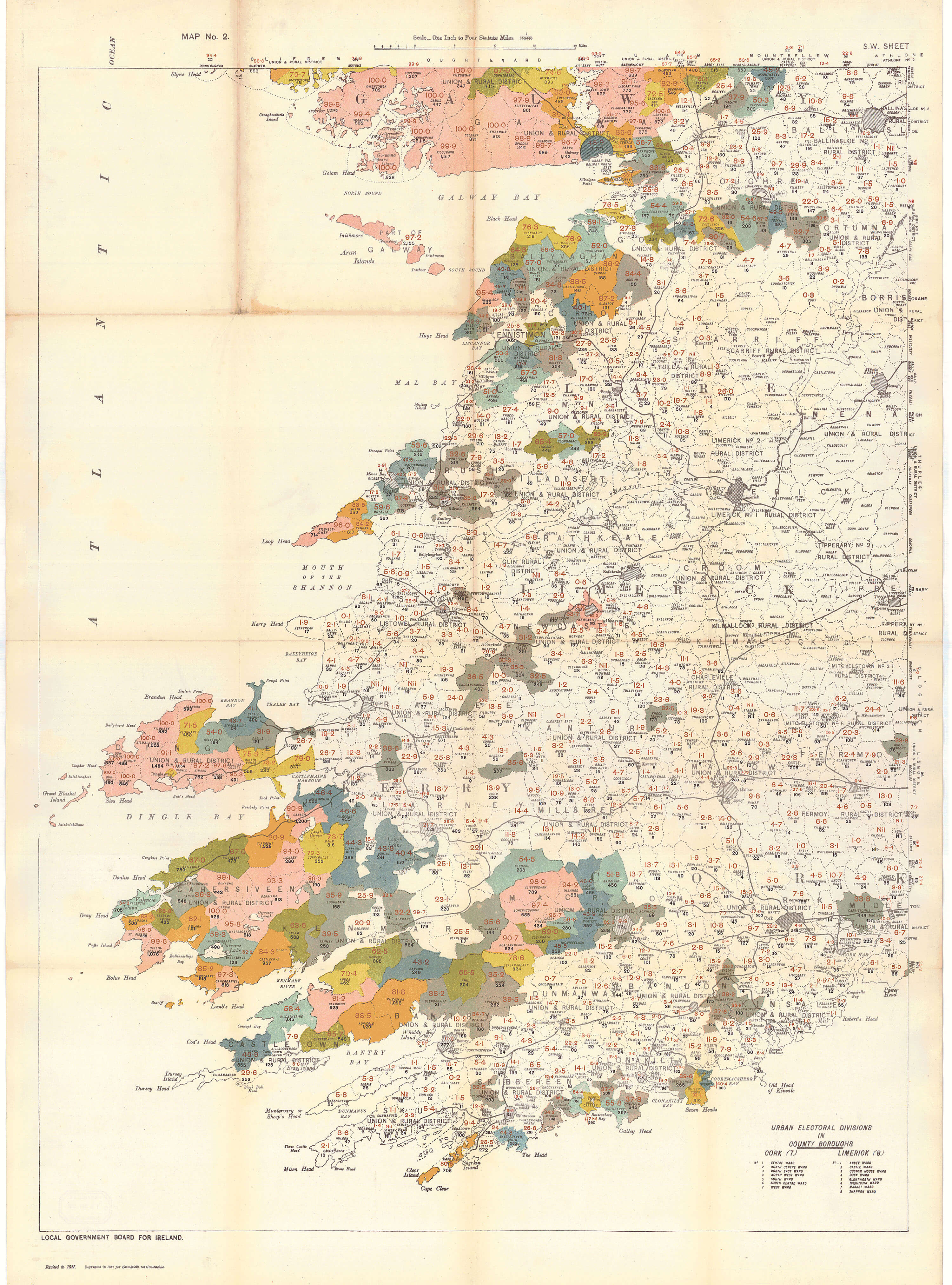
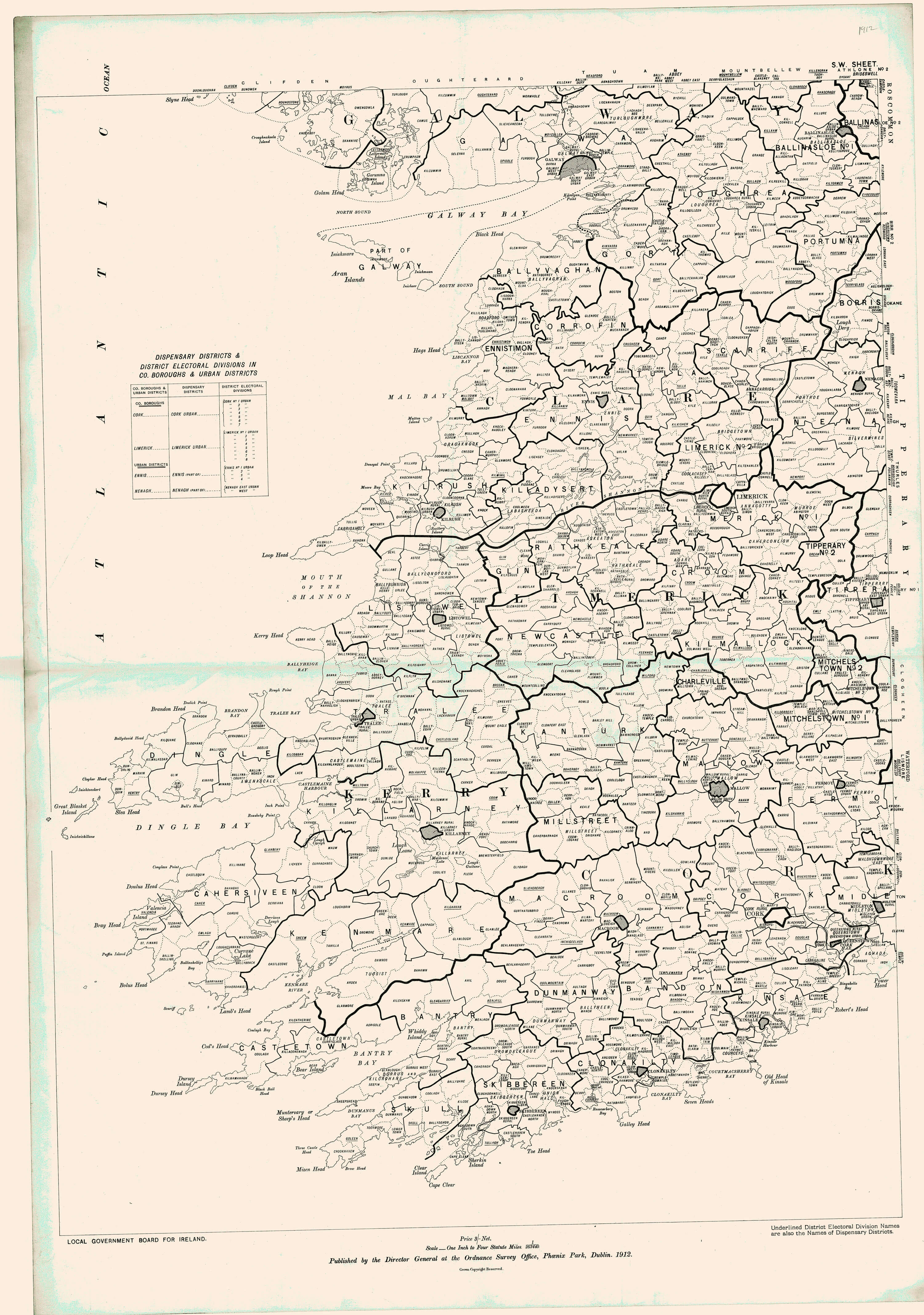
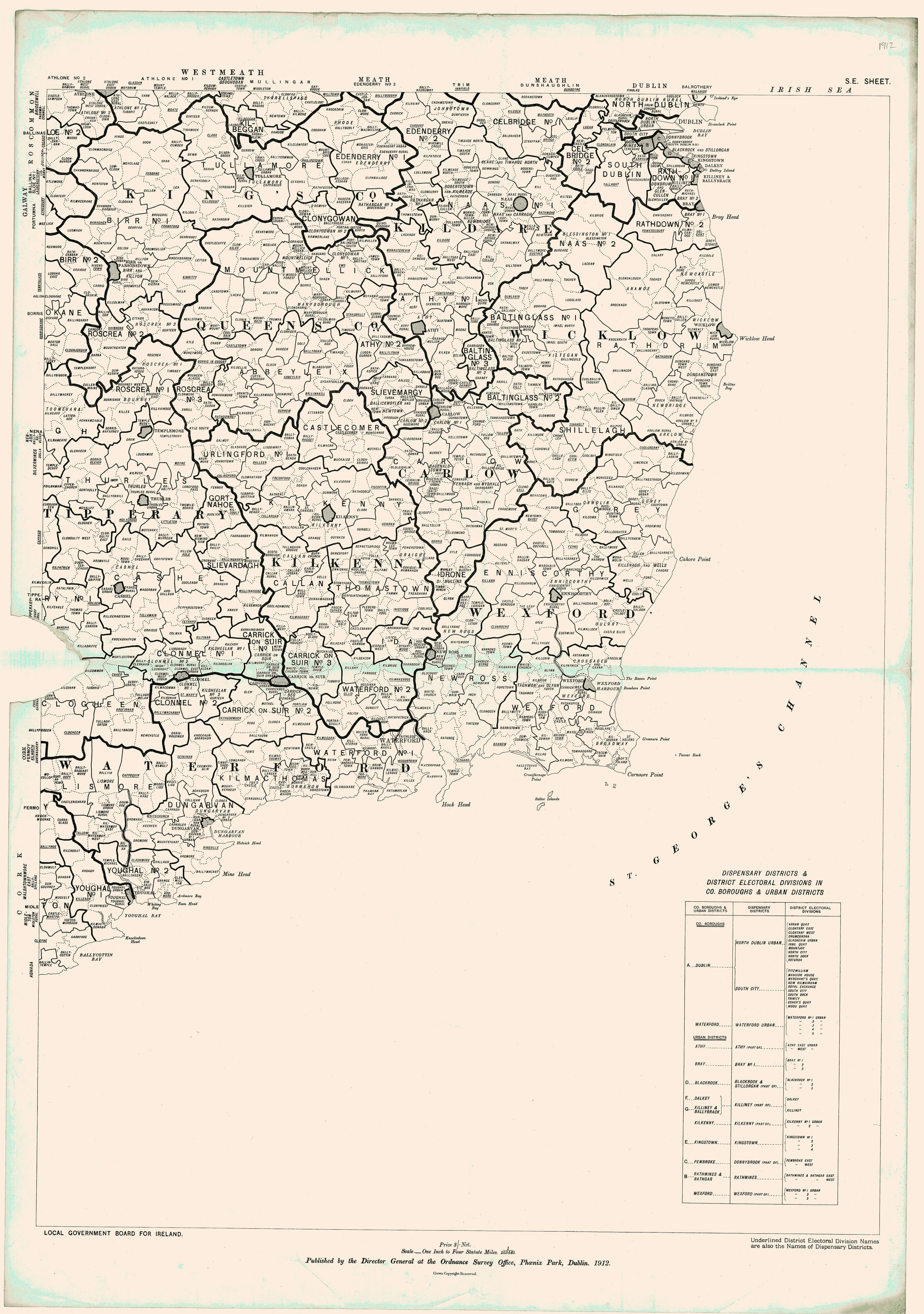
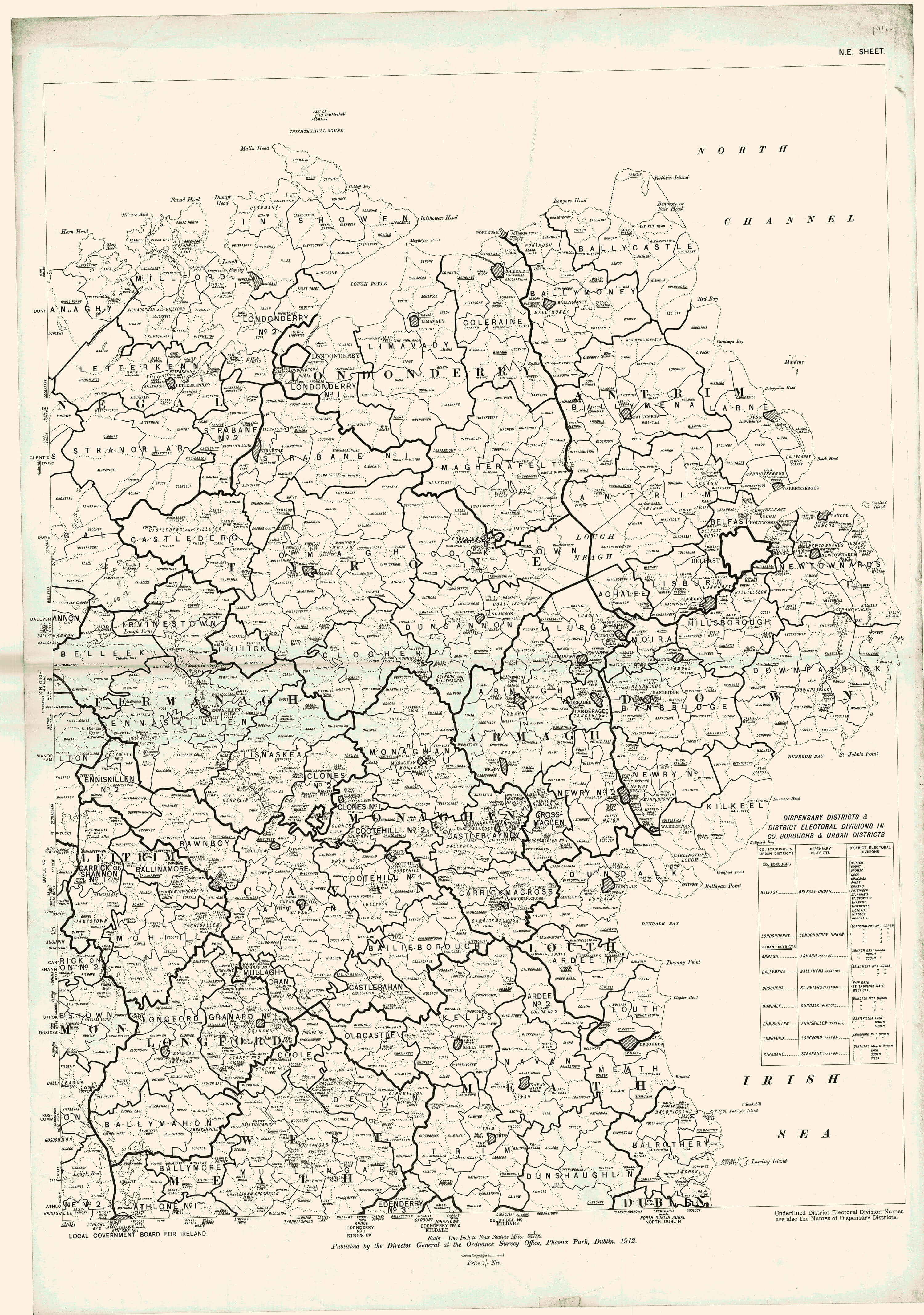
DED’s are one of the cornerstones of land management. They were also used for the Special Enumeration Survey of 1917 which recorded the percentage of Irish Speakers in each DED.
(Image Full Screen plus Zoom and Pan controls are located in top right of Gallery when opened)