Grand Juries were established in the 18th century “to determine whether there was a good case for criminal prosecutions to take place”. Later they took over some of the functions that were carried out by county councils such as bridge building and road maintenance. By the mid century, such functions as hospital building were taken over by the poor law unions. The Local Government Act of 1899 transferred administrative and fiscal functions to the county councils.
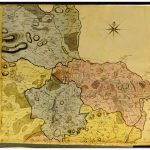
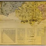
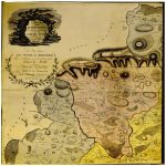
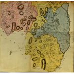
A number of county maps were commissioned by Grand Juries between 1760 and 1820. These were a significant advance on previous county maps. They were produced by foremost mapmakers and preceded the Ordnance Survey map projects by up to half a century.
The maps of County Laois were produced by David Cahill in1805
(Image Full Screen plus Zoom and Pan controls are located in top right of Gallery when opened)