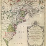
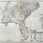
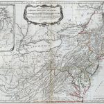
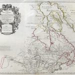
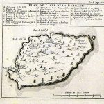
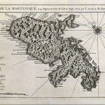
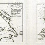
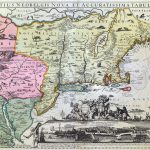
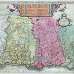
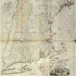
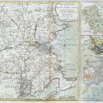
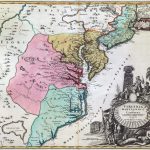
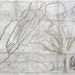
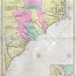
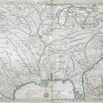
This is a fine selection of 18th century maps of North America. There are important maps by De L’Isle, Homan,Van Keulan (chart) and Popple. The large maps are attractive with many in colour with artistic cartouches and a large amount of information. There are many maps of the Carribean and the West Indian islands indicating the importance of this area in the 1800s to the British, French and Spanish empires.
(Image Full Screen plus Zoom and Pan controls are located in top right of Gallery when opened)
Click any image to open Gallery
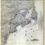
F22-1-N America-Bowen-1775
F22-2-Covens & Mortier
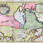
F22-3-N America-De L’Isle
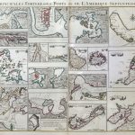
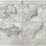
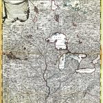
F22-4-Ports of N America
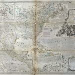
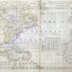
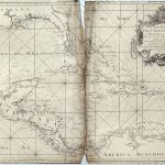
F22-5-N Atlantic Chart-Jefferies
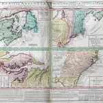
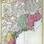
F22-6-English & French Possessions-Palairet-1756
F22-7-English & French Possessions-Palairet-1756
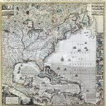
F22-8-B Empire in America-Popple
F22-9 Empire in America-Popple
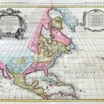
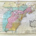
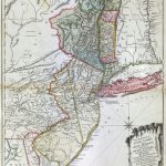
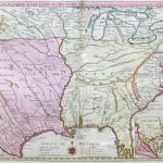
F22-10-British Dominions in N America-Homan
F22-11-British Dominions in N America-Homan
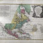
F22-12-British Possessions in N America-Homan
F22-13-New Map of British America-Lotter
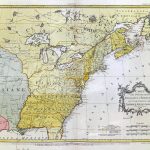
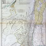
F22-15-British Colonies in N America-Romans-1776
F22-16-British Colonies in N America-1776
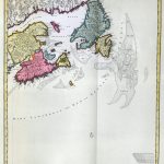
F22-17-New Scotland-De Hondt
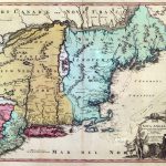
F22-18-Canada or New France-De L’Isle-1703
F22-19-N America & Canada
F22-20-Canada-Jaillot
F22-21-New France
F22-22-N America-Visscher
F22-23-New France-Visscher
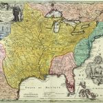
F22-24-N America-Homan
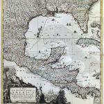
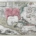
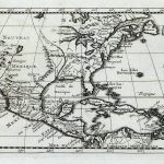
F22-25-C America-De L’Isle
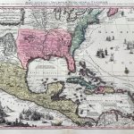
F22-26-1-C America-Seuter
F22-26-2-C America-Seuter
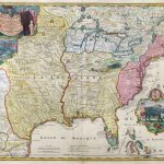
F22-27-C America-Homan
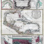
F22-28-West Indies
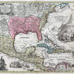
F22-29-C America-D’Anville-1731
F22-30-Gulf of Mexico
F22-31-Gulf of Mexico-de la Cruz-1755
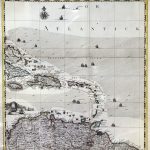
F22-32-West Indies Chart-Van Keulan
F22-33-West Indies Chart-Van Keulan
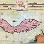
F22-34-Curacao-Chart-Van Keulan
F22-35-Curaco Chart-Van Keulan
F22-36-West Indies -Van Keulan
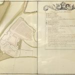
F22-37-Fort Amsterdam-Curacao
F22-38-Fort Amsterdam-Curacao
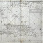
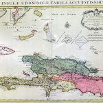
F22-39-Hispaniola-Van Keulan
F22-40-Dominique-De Fer-1723
F22-41-Dominique-De L’Isle-1725
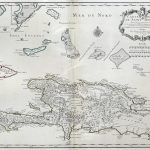
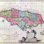
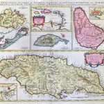
F22-42-Jamaica-Visscher
F22-43-Jamaica-Visscher
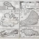
F22-44a-West Indies
F22-44b-West Indies
F22-44c-West Indies
F22-44d-West Indies
F22-44e-West Indies
F22-44f-West Indies
F22-44g-West Indies
F22-45-West Indies
F22-46-West Indies
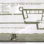
F22-47-Martinique-1719
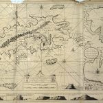
F22-48-Eyeland St Thomas-Van Keulan 1719
F22-49-British Islands in N America-Lea
F22-50-West Indies
F22-55-West Indies
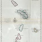
F22-56-Carribean Islands-Ottens
F22-57-Carribean Islands-Ottens
F22-58-Carribean Islands-Ottens
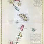
F22-59-Carribean Islands-De L’Isle
F22-60-1-Coast of Canada-Sayer & Bennett-1776
F22-60-2-Coast of Canada-Sayer & Bennett-1776
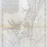
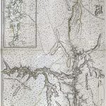
F22-61-Hudson River-Sayer & Bennett-1776
F22-62-Cape Fear Island-Sayer & Bennett-1776
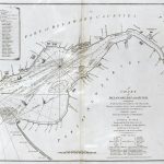
F22-63-Delaware Bay & River-Fisher-1776
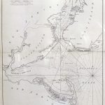
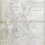
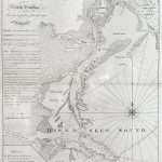
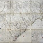
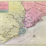
F22-64-S Carolina-Gascoigne-1776
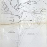
F22-65-Boston Harbour Chart
F22-66-S Carolina-Gascoigne-1776
F22-67-East rbour Florida-Blaney-1775
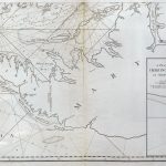
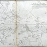
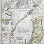
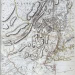
F22-68-Hudson River New York Ontarion
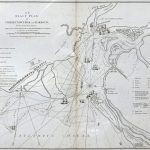
F22-69-Charlestown Bar & Harbour- Sayer & Bennett-1776