Ireland Barony Maps County Waterford
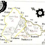
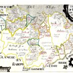
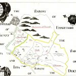
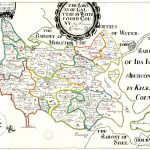
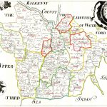
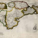
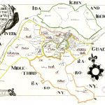
A suite of barony maps produces as part of the Down Survey Project in the 18th century. The project involved a major survey of land ownership managed by Sir William Petty. He also produced the first accurate survey of Ireland which corrected major errors in the west and north coasts. The barony maps include a an early coloured edition of Petty’s county maps. Barony and parish maps are also shown on a set of county maps by Richards 1906.
(Image Full Screen plus Zoom and Pan controls are located in top right of Gallery when opened)
To purchase a digital print of any map click this text – BUY A MAP
TO PURCHASE A PRINTED MAP
2
MAKE PAYMENT
Invoice Will Be Emailed
Pay online or
by Bank Transfer
3
RECEIVE MAP
Map Will Be Printed
And Sent To You By Post
Within One Week
MAP SIZES AND PRICING
Note* Original maps in the collection for print are of a much larger size
and higher visual quality than the reduced file size copies uploaded to this website.
Size Tax Shipping
Price in Euro’s includes Vat Tax at 13.5%
Price includes post and packaging (shipping)
Maps can also be produced at any size
Custom Size Prices on request
60x40cm or 24x16in
Send to Ireland – €59
Send to Uk, Europe – €59
Send to USA – €59
90x70cm or 36x28in
Send to Ireland – €79
Send to Uk, Europe – €99
Send to USA – €99