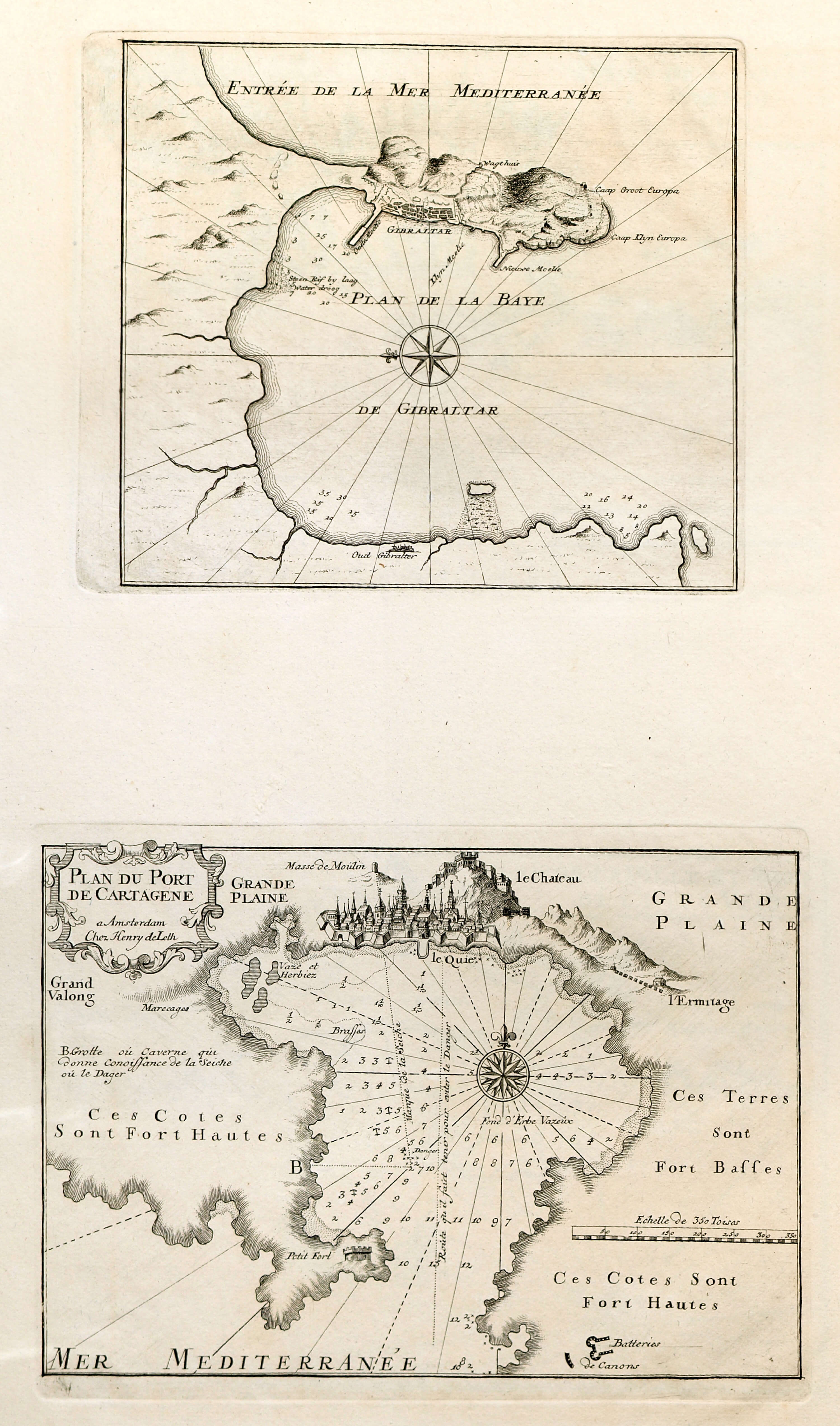
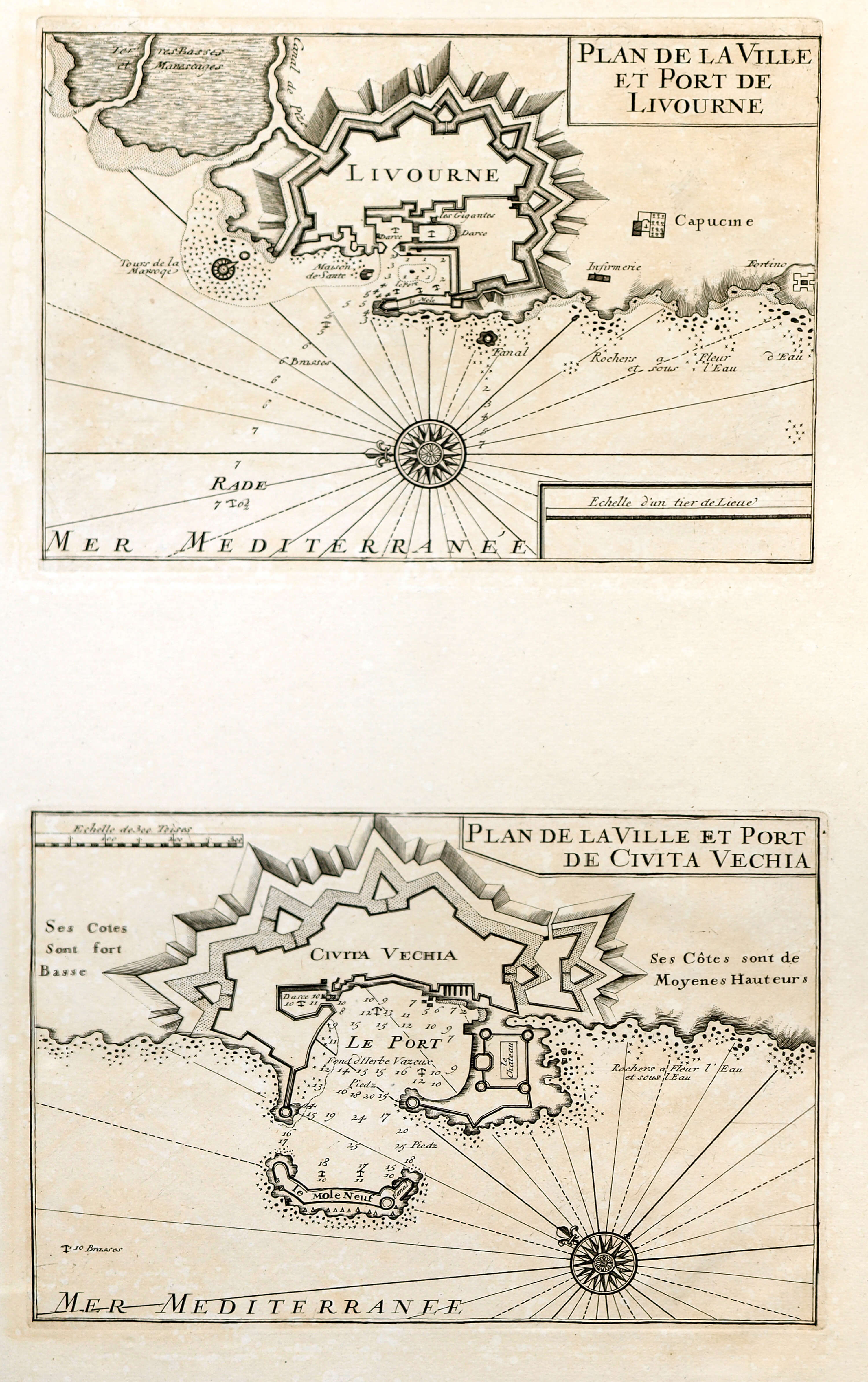
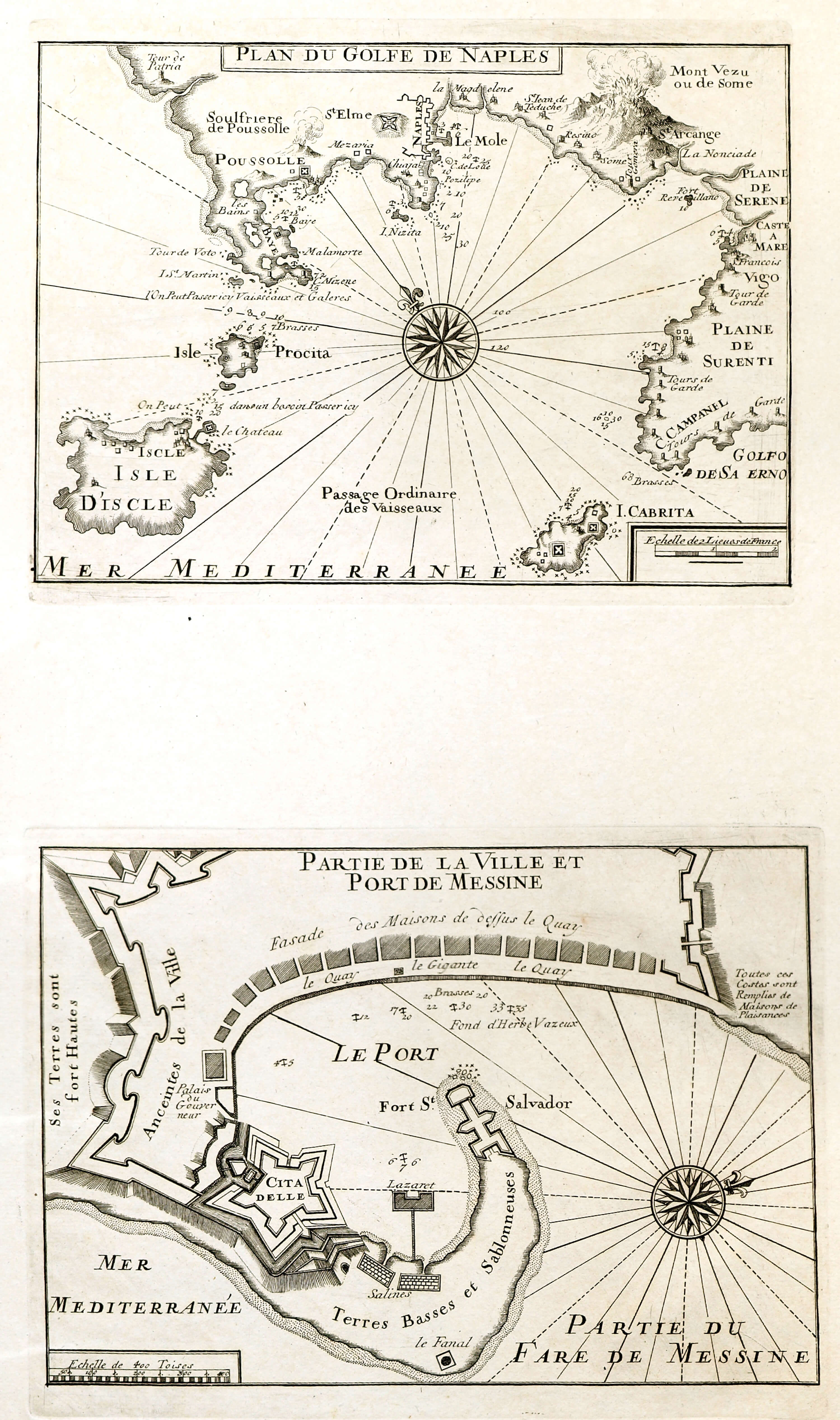
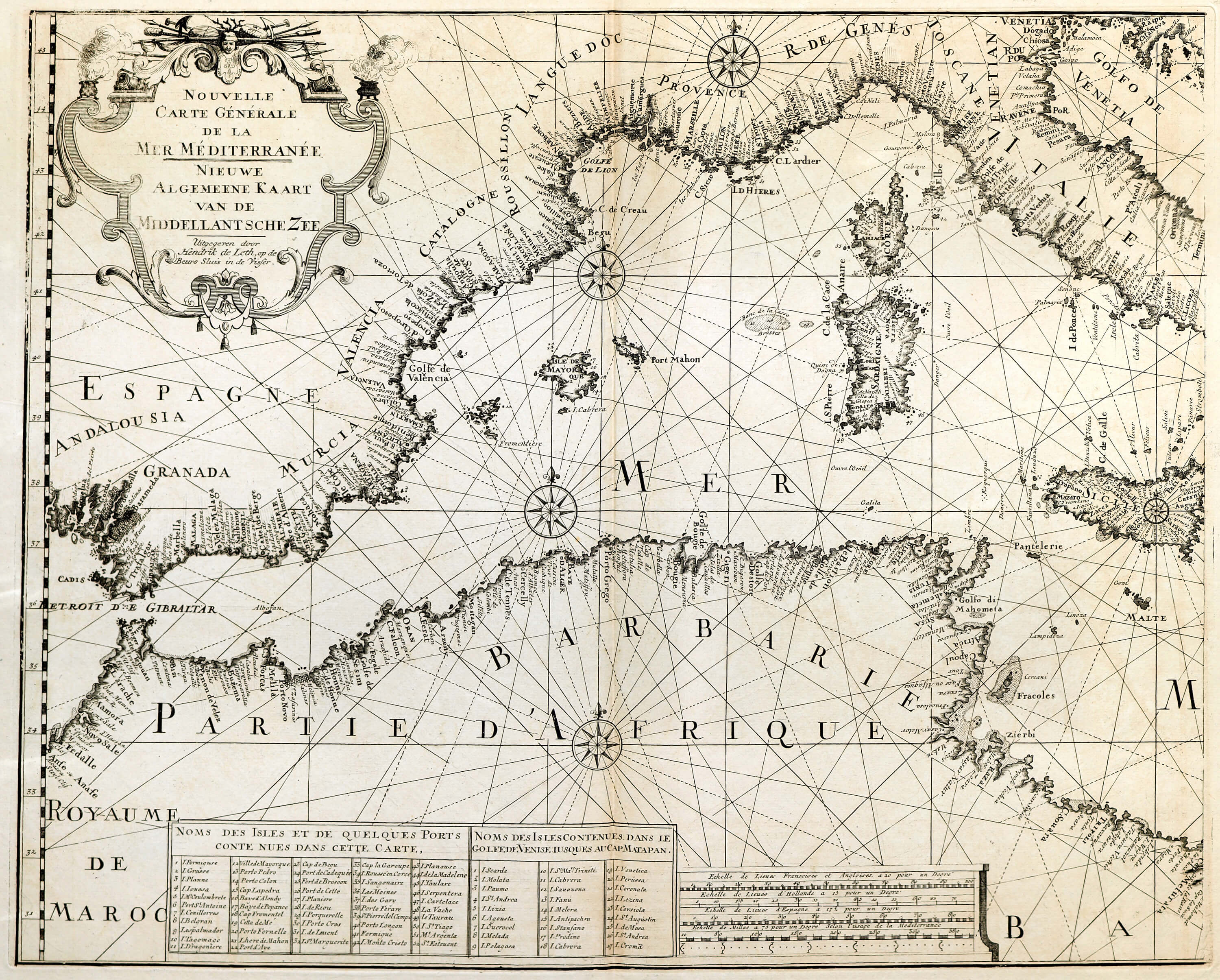
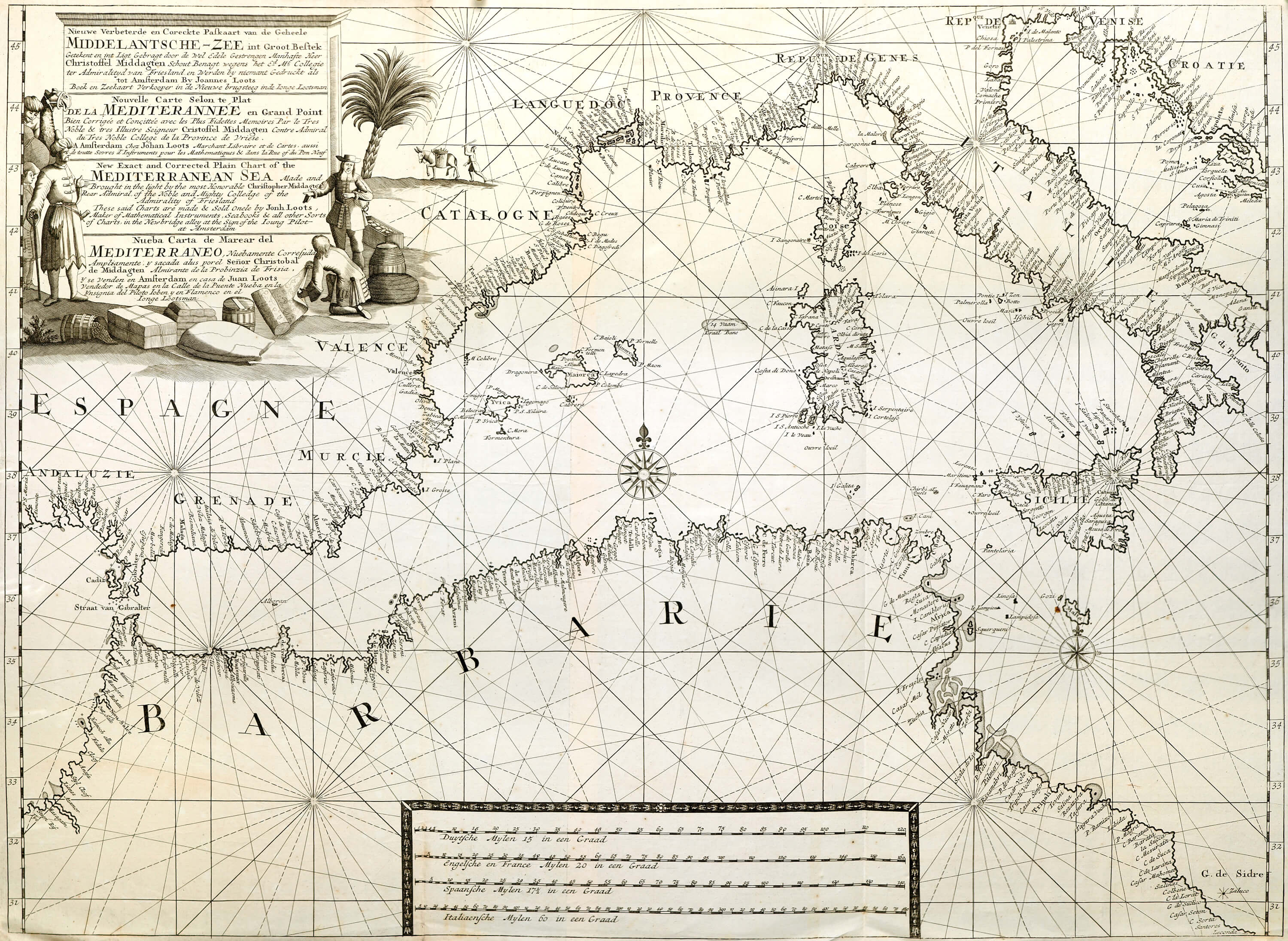
A unique suite of charts and maps of the Mediterranean region. There is a significant set of maps of Gibralter-Cueta and also the Balearics and a set of plans of Mediterranean ports.
The Historic Atlas section of the lbrowncollection.com collection contains many atlases that include maps of The Mediterranean. This suite of maps greatly augments these atlases.
(Image Full Screen plus Zoom and Pan controls are located in top right of Gallery when opened)
Click any image to open Gallery
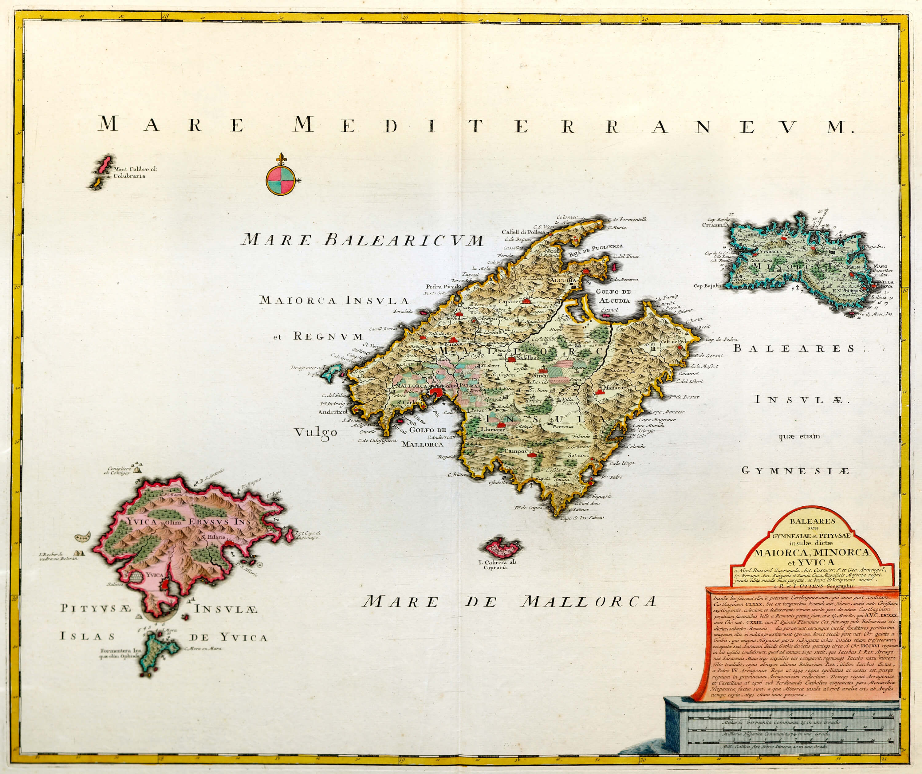
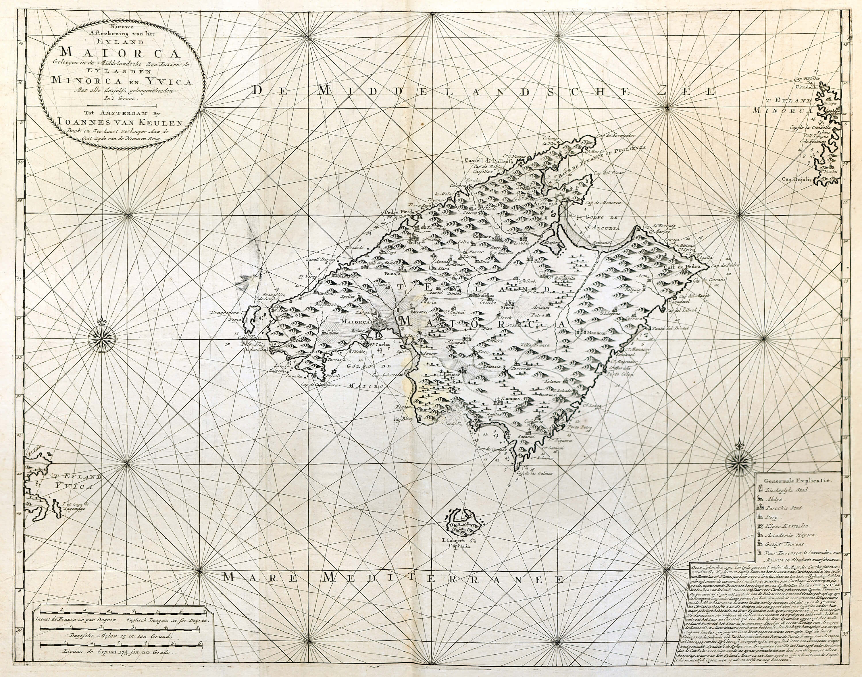
Mediterranean-Balearic Islands-F6-101
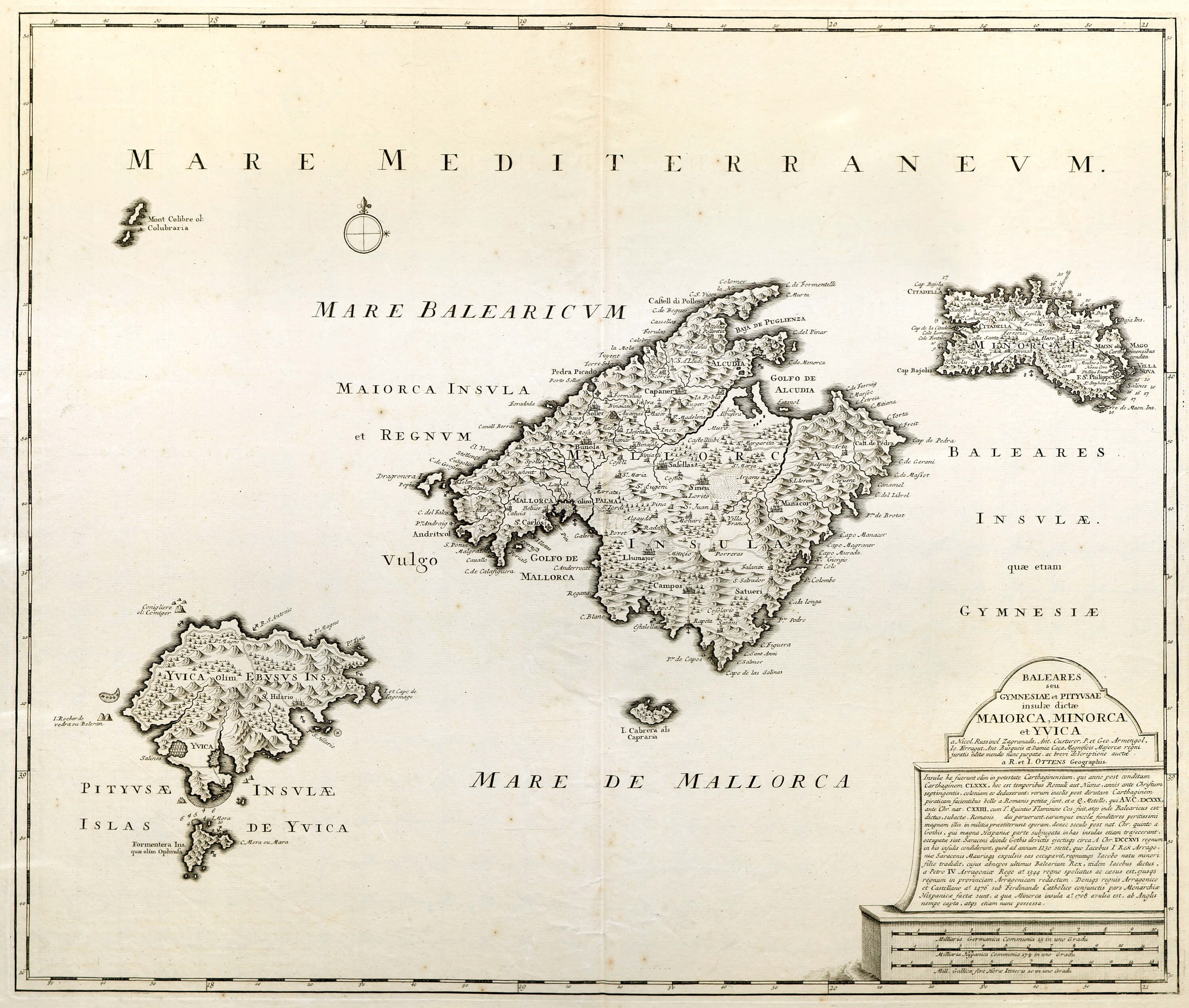
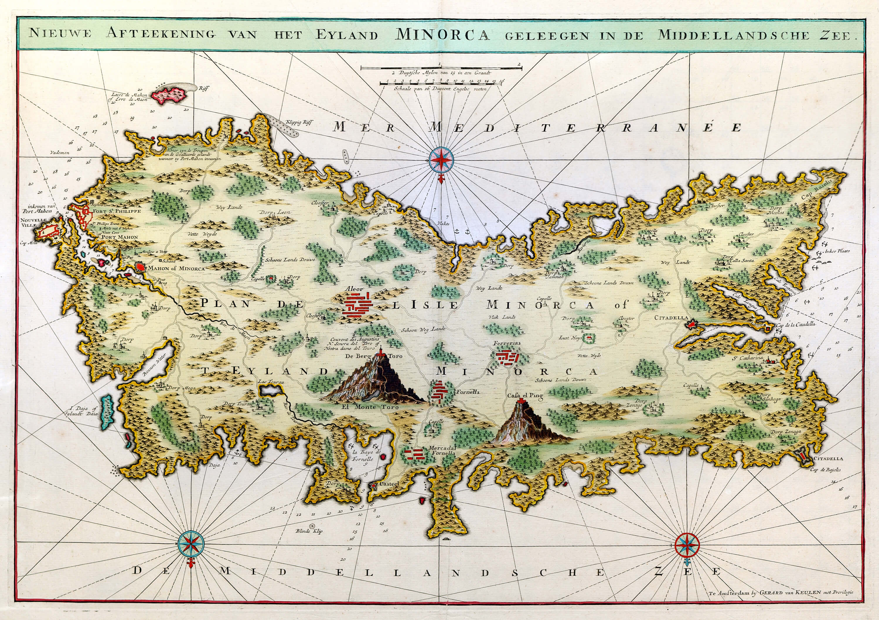
Mediterranean-Balearic Islands-F6-102
Mediterranean-Central-Chart-F6-82-2
Mediterranean-Corsica-Chart-F6-84
Mediterranean-East-Chart-Covens & Mortier-F6-82-1
Mediterranean-East-Chart-F6-83-2
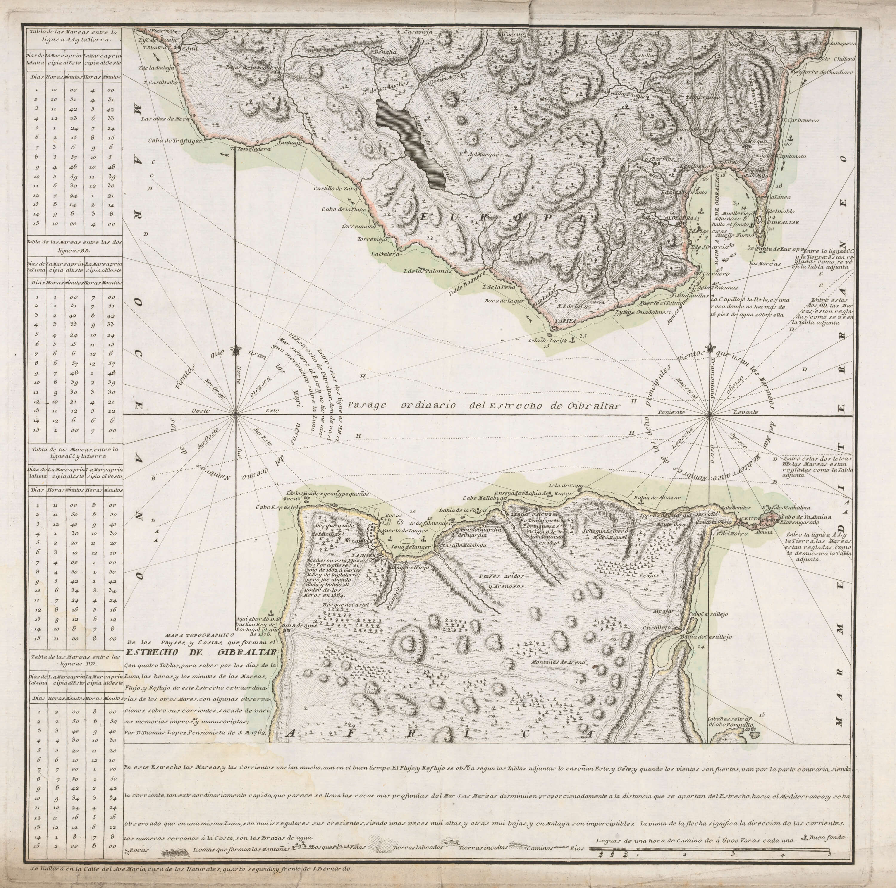
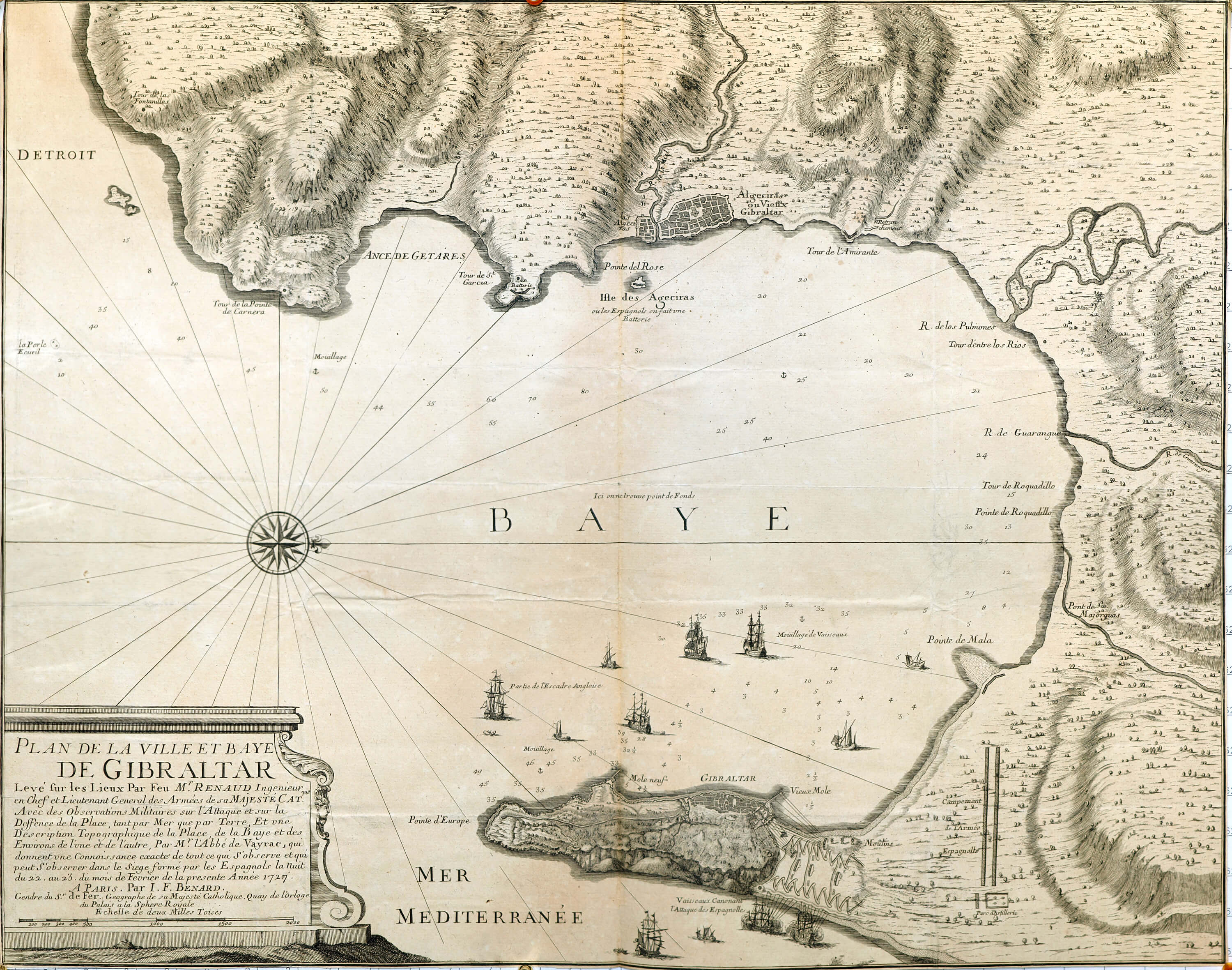
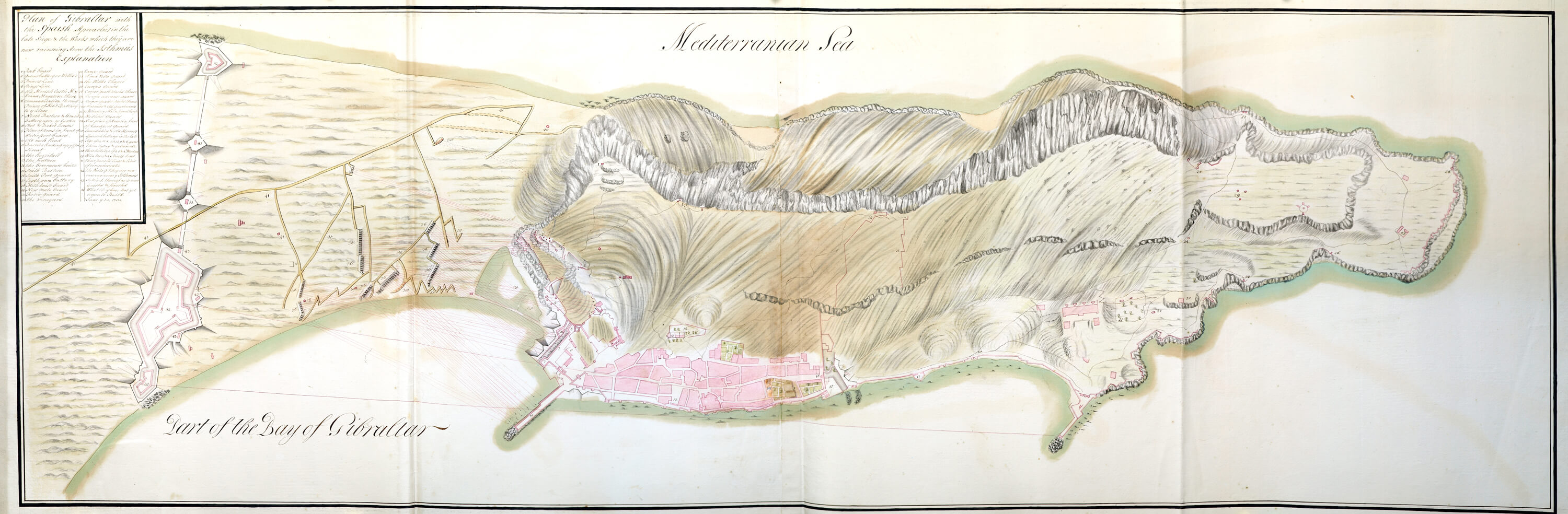
Mediterranean-Gibralter-Cueta-F6-89
Mediterranean-Gibralter-Cueta-F6-90
Mediterranean-Gibralter-Cueta-F6-91
Mediterranean-Gibralter-Cueta-F6-092_1T
Mediterranean-Gibralter-Cueta-F6-93
Mediterranean-Gibralter-Cueta-F6-94
Mediterranean-Gibralter-Cueta-F6-95
Mediterranean-Gibralter-Cueta-F6-96
Mediterranean-Gibralter-Cueta-F6-99
Mediterranean-Gibralter-Cueta-Views-F6-97
Mediterranean-Gibralter-Cueta-Views-F6-98
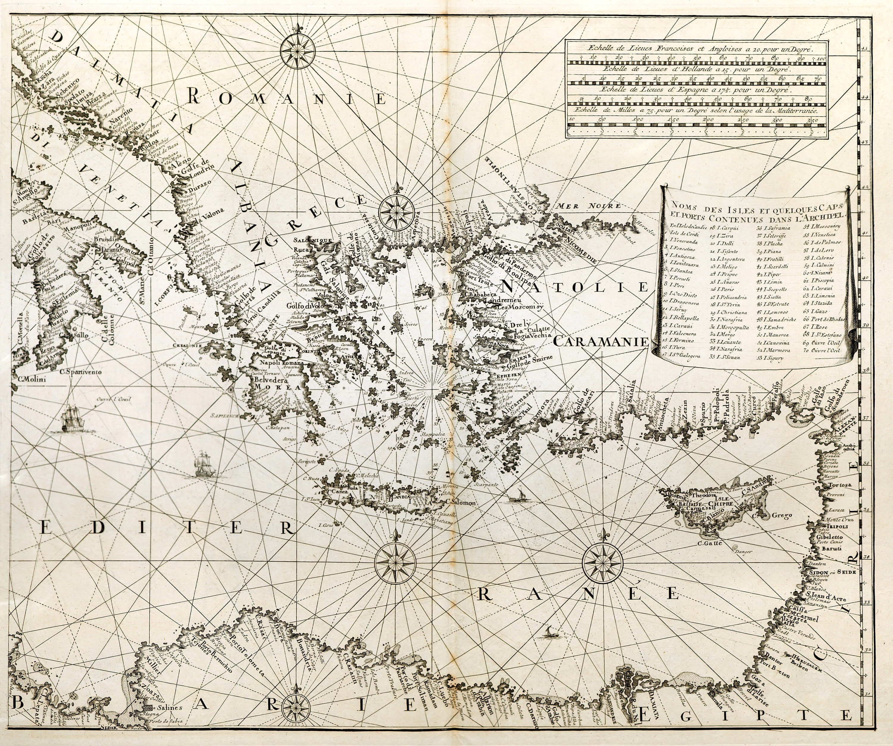
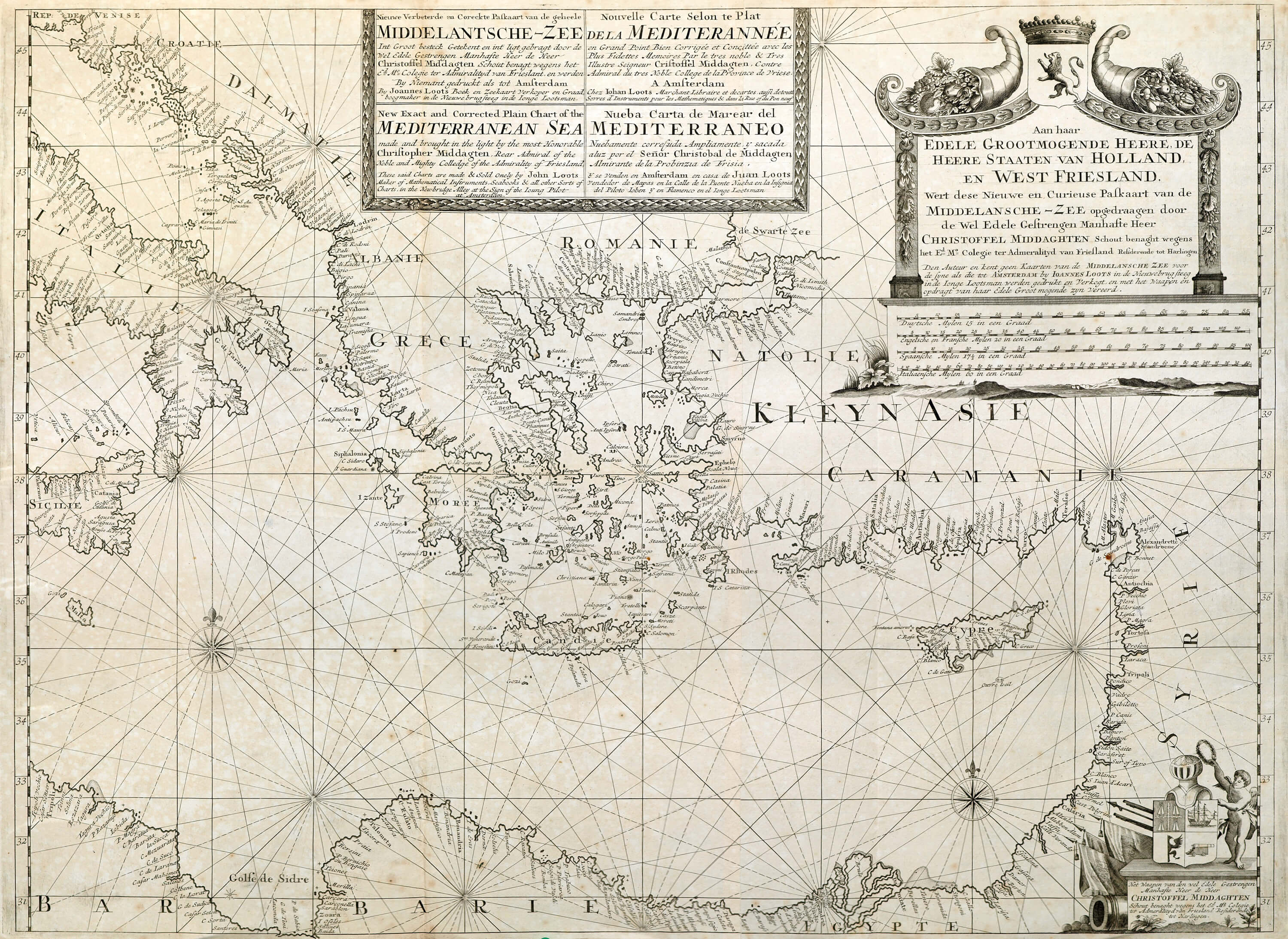
Mediterranean-Greece-Chart-F6-88
Mediterranean-Isle D’Elbe-F6-109
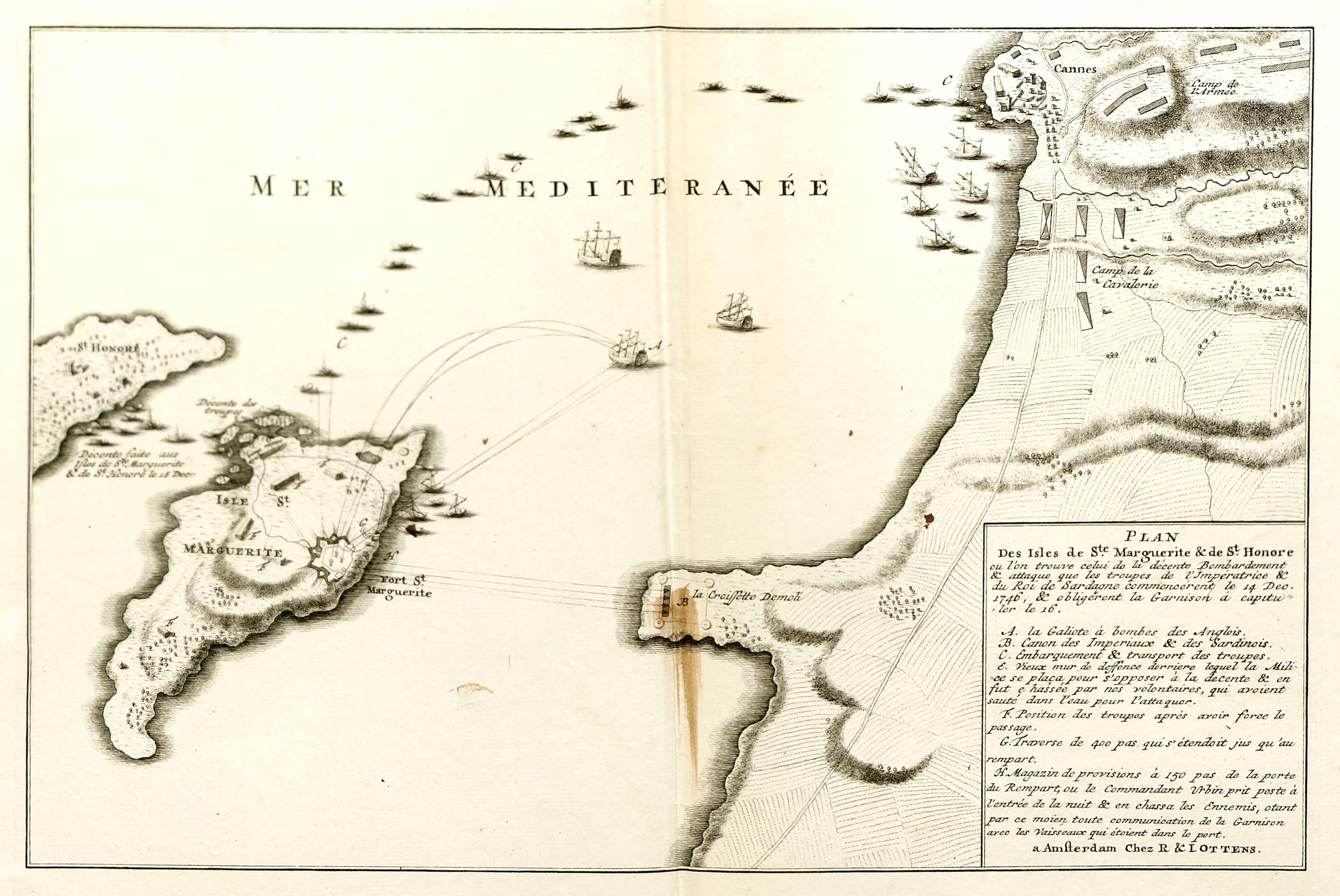
Mediterranean-Isles St Margurite & St Honore-F6-108